Once we were full of good food and drink from our pub lunch, we piled back onto the coach and headed for the Petrie Museum to see items that were either sold or donated directly to this museum by the archaeologists who found them.
I have to admit that I am an Egyptian archaeology junky and always have been. I saw my first mummy at about age 7 or 8 and was hooked. It was fully wrapped and had a few items nearby, including its coffin. Since then, any museum that I visited that had anything Egyptian caught my attention.
What made this particular trip a “must do” included the brand new Grand Egyptian Museum and the National Museum of Egyptian Civilization (where 22 royal mummies are kept and shown to the public). Then there were the temples and experiences that I did not have during my first trip to Egypt back in 2008 – Sakkara, Dendera Temple, Esna Temple, watching Nubian dancers (and ending up dancing with them), visiting a Nubian Village, sailing on a felucca, and riding a motorboat on the Nile. The final piece that made me really want to do this was the pre-cruise tour involving all of the Egyptian stuff in London and Oxford.
Even when it came to the parts I had done before, back in 2008 I was just recovering from a two-year fight with an illness that had involved surgery and six months of chemo. I did not have my full energy back then and was also just getting used to living with hypothyroidism (that I had gotten from the chemo). I am actually in much better physical condition here in 2026 than I was 18 years ago. I could engage with what I was seeing, doing, and experiencing so much easier and more fully now. Plus being 60 pounds lighter now than before helped me to say, “Hey. I’m going to ride a camel.”
The Petrie Museum of Egyptian and Sudanese Archaeology is part of London’s University College Museums and Collections. It contains over 80,000 objects, making it one of the world’s largest collections of Egyptian and Sudanese material.
The museum was established in 1892 as a teaching resource for the Department of Egyptian Archaeology and Philology. In 1913, William Matthew Flinders Petrie sold his collection of artifacts from all of his years conducting major Egyptian excavations to University College. This created the Flinders Petrie Collection of Egyptian Antiquities and transformed the museum into one of the leading collections outside of Egypt.
At this point the museum was still for the use of students and academics. It was not yet open to the public. Over the years other archaeologists added to the collections housed at the Petrie Museum.
One of the significant holdings of the Petrie Museum is a limestone head of a king. Petrie thought it could have been King Narmer, based on the similarity to another head of Narmer that he had encountered. Others have thought that it is more likely to be the Fourth Dynasty King Khufu. Narmer had been an Early Dynastic king who was credited with the unification of Egypt. Essentially the first king of both Upper and Lower Egypt.
A garment called the Tarkhan Dress, from the fourth millennium BC, is considered to be the oldest known woven garment in existence. There is also a completely see-through dress made of beads. It was possibly worn over a linen dress like the Tarkhan dress.
In one case, I saw some figures of Isis and Horus as well as one of Isis with baby Horus. At that point, I did not yet know that I would end up playing the role of Isis in our Egyptologist’s explanations of Egyptian mythology. That would not happen until we were actually in Egypt and seeing the temples.
I found the collections at the Petrie to be quite amazing to see and highly recommend seeing them to anyone who, like me, really loves Egyptian archaeology and the objects it unearths.
Next – Sir John Soanes’ fascinating home by candlelight
Exterior of Petrie MuseumIsis and Horus figuresNarmer or Khufu?Tarkhan DressA bead dressPart of an enormous collection of pottery
Having set my wake-up call for 6:30am and my breakfast delivery for 7am, I needed to make sure that I would be awake and dressed by when my doorbell rang. I had taken my shower the night before to cut down the morning time and was dressed on time. Whew!
I actually felt pretty perky and was ready to roll when we assembled down in the lobby at 8:15am to walk over to the British Museum. They didn’t open until 10am, but we had a private viewing of the Egyptian collection set for 8:30am. We were a smidge early. They let us in, giving us a little extra time. We entered and walked up the stairs to the third floor and started our tour in Galleries 62 & 63.
For anyone not familiar with the British Museum, it is a public museum, located in the Bloomsbury district of London, which is dedicated to human history, art, and culture. Established in 1753, they have a permanent collection of eight million objects, with roughly 80,000 of those objects on public view, making it the largest museum in the world. It was also the first of its kind – a free, public, national museum.
In the early 1800s, the museum expanded its collection of Egyptian sculpture, with its acquisition of the Rosetta Stone (1802) and the colossal bust of Pharaoh Ramesses II (1818). They also acquired several pieces after the defeat of the French in the Battle of the Nile.
In Galleries 62 & 63, the death and afterlife, which held particular significance and meaning for the ancient Egyptians, is explored. This includes mummies, coffins, funerary masks, portraits, and other items designed to be buried with the deceased. Mummification, magic, and rituals are explored.
Several internal organs were removed and preserved in canopic jars. These were the lungs, intestines, stomach and liver. The brain was also removed (through the nose), but wasn’t considered to be important, so it was thrown away. The heart was kept in the body.
Small figures called shabtis were buried to magically provide for the deceased in the afterlife. Animals considered to be sacred, like bulls, crocodiles, cats, and falcons, were also mummified.
One of the highlights of these galleries is the Book of the Dead of Hunefer, which shows scenes of Hunefer’s judgement. He was a royal scribe and an overseer of cattle. It is celebrated as one of the finest surviving examples of the Book of the Dead in the world. Due to the fact that, as ancient papyrus, it needs to have special care, it is not always on public display. We were very fortunate to be able to see and photograph it.
The Book of the Dead of Hunefer dates to the 19th Dynasty (c. 1310 – 1275 BC). It contains magical spells and guides meant to help the deceased safely navigate the underworld and reach the afterlife. It is most famous for its illustrations depicting the journey through the afterlife. These included the following rituals: 1) The Opening of the Mouth – which restores the deceased’s senses so they could eat, drink, and speak in the afterlife; 2) The Weighing of the Heart – in which the deceased’s heart is weighed against the feather of Ma’at (representing truth and justice) on a scale overseen by the jackal-headed god Anubis; 3) The Devourer – if the heart was heavy with sin, it was consumed by Ammit, a hybrid beast composed of a crocodile, lion, and hippopotamus; 4) The Presentation to Osiris – if the deceased passes the judgement, they are deemed “true of voice” and taken by Horus (the falcon-headed god) to Osiris, the lord of the underworld. Osiris is shown sitting under a canopy with his sister Nephthys and his wife (who was also his sister) Isis.
Since I have an issue with my back that doesn’t tolerate standing in one place for too long, I love the modern whisper devices that allow me to hear what the person showing us around is saying without needing to be all that close to them. That lets me keep moving around while I am listening. I can also take loads of photos without too much of a crowd. That’s why most of the photos I took in the British Museum have so few other people in them.
I took a lot of photos (131 that I kept). There were so many great items to photograph. Plus the lack of people outside of my group of eighteen meant that I had a chance of getting some good ones. In more crowded situations (or more rushed) later on in the trip, I might not be so fortunate.
Once we had explored those two galleries, we moved on to Gallery 64. This one concentrated on the beginnings of ancient Egyptian civilization from about 11000 BC along the Nile.
The annual flooding of the Nile created fertile land ideal for growing crops. The culture rapidly advanced in technology and social organization during the 5th millennium BC. By the end of the Predynastic period (about 3300 BC), regional rulers began competing for power and territory. This ultimately led to the unification of Egypt in about 3100 BC. This was believed to have been under King Narmer. Egyptian hieroglyphs were invented about 3200 BC and were used for almost 4,000 years.
The first royal tombs were built in the Egyptian desert at Abydos, 56 miles (90km) north of Luxor. Funerals at this point of Egyptian history were simple and didn’t involve mummification, which was a practice that began about 2500 BC. They had a couple burials from this time in Gallery 64, which I did photograph, but thought they might be a bit much for some people who might not want to see them.
The strong central increase in wealth led to dramatic achievements in architecture, writing, and the arts. This culminated in the Great Pyramids of Giza in about 2600 BC.
Two special treasures that I photographed in Gallery 64 were the Statue of Ankhwa and the Pitt-Rivers Knife. Ankhwa was a ship-builder who was shown holding an adze, a woodworking tool indicative of his trade. This dates to roughly 2686 – 2613 BC (3rd Dynasty), was made of red granite and was probably found in Sakkara (formerly Memphis).
The Pitt-Rivers Knife (named after the archaeologist who discovered it), has an ivory grip decorated with rows of animals in relief and a flint blade with a serrated lower edge. The caramel-colored flint portion of the knife is distinctive and is of a type known as a ‘ripple-flaked knife’. At the time of the knife’s purchase for the museum its date was unknown, but in 1894 the pioneering archaeologist W.M.F. Petrie came across examples of similar knives among the grave objects in a large cemetery at Naqada. Petrie and Pitt-Rivers knew each other and were both determined to figure out when it was made. Eventually it was determined it belonged to prehistoric times. The period became known as the Predynastic (c. 4500 BC – 3100 BC) and the knife was subsequently dated to roughly 3200 BC. It was believed to have been used for ceremonial purposes only.
Next we took a glance at the items in galleries 65, 66, and 61 before heading downstairs to Gallery 4 on the ground floor. This contained the Egyptian sculpture gallery, which represents three millennia of history. The monuments displayed here were meant as vehicles for the spirits of deities, kings, and officials, and were originally placed in temples and tombs.
Our first stop was the Rosetta Stone. By this time, the museum had just opened. People were already swarming around the Rosetta Stone and posing in front of it. This made it difficult to get a decent photo of it. Patience was required, but seemed to be quite thin among several of the people there who weren’t part of our group. One woman tried to pick a fight with me, but I didn’t let her.
On my first visit to the British Museum, back in 1983, the Rosetta Stone wasn’t protected by glass and didn’t seem to hold that much interest for people. It was more of a side note. This time, it was getting nearly as much attention as the Mona Lisa does at the Louvre.
The Rosetta Stone served as the key to deciphering the ancient Egyptian language of hieroglyphics. It was stumbled upon in 1799 by a group of French soldiers who were digging foundations for a fort in the town of Rashid (or Rosetta) near Alexandria. Fortunately, they immediately recognized that their find was important.
The three languages carved into the stone are: Hieroglyphs, Ancient Egyptian Demotic script, and Ancient Greek. The presence of Greek was the main key to deciphering the hieroglyphs.
The largest Egyptian sculpture in the British Museum is of Pharaoh Ramesses II, who reigned through most of the 13th century BC (for 66 years) and died at the ripe old age of 96. The full, seated statue originally stood at the Ramesseum, Ramesses II’s memorial temple on the West Bank of the Nile at Thebes (now Luxor). It was one of a pair which faced the Nile and the temples of Karnak and Luxor on the other side of the river.
It was cut from a single block of two-tone granite and granodiorite, one of Egypt’s hardest and most prized stones, chosen for both symbolism and durability. In the closeup photo I have included, you can see that the face and crown are more of a pinkish color than the rest of the statue. This was on purpose for visual impact between the dark, earthy contrast of the body (evoking Egypt’s fertile, black soil) with the more ethereal connotations of the lighter, pinkish face and crown. I also caught a nice photo of the head of Amenhotep III.
Another photo that I captured (and doesn’t look like much) is part of the Great Giza Sphinx’s missing beard. I thought that was pretty cool to see. After we left the Egyptian sculptures in Gallery 4, we took a short visit to the Parthenon Sculptures in Gallery 18.
Not too far from the museum, a coach was waiting for us to take us on a sightseeing tour of London for about an hour. They made sure to include the Egyptian obelisk they call “Cleopatra’s Needle” along the Victorian Embankment. It is actually one of a pair of obelisks that were carved during the New Kingdom period and inscribed by both Thutmose III and Ramesses II. Both obelisks were on display in Alexandria for almost two millennia. Then, they were sent to London (gifted 1819, erected in 1878) and New York City (gifted 1869, erected in 1881).
After our sightseeing tour, we were taken for a pub lunch. We put in our orders the day before so the food would be ready shortly after we arrived. We sat all together in an upstairs room of the pub. We had a couple choices for a main course and a dessert plus several choices for beverages. I usually like to get whatever the best draft ale, lager, or stout might be in any particular pub or possibly a draft hard cider. This time, I got a pint of the ale with fish and chips and a sticky toffee pudding. I found a taker for the mushy peas that came with the fish and chips. I definitely had the vinegar on the fish as well as the tartar sauce.
After lunch, we headed for the Petrie Museum at the University of London.
Next – A special museum of artifacts from Egypt and the Sudan at the University of London – the Petrie Museum
EntranceGallery 62 & 63More of Gallery 62 & 63Oldest human-shaped coffin in museumAncient textilesStatue of AnkhwaPitt-Rivers KnifeA boat for the afterlifeEyes of Horus for protectionAn actual mummy with his coffinMore coffinsEven more coffinsSome grave goodsA shieldSome mummified catsCanopic jarsBook of the Dead of HuneferThis one looks like they are winkingRosetta StoneRamesses IIPart of Sphinx beardMore statuesList of Egyptian rulersAmenhotep III (left)Thinking this might be Djoser?Akhenaten — Tut’s dad
I arrived at the hotel in the Fitrovia district of London at about 9:30am. The room wasn’t ready. Although check-in time was officially 3pm, I was told at the desk that they would make me a priority. They checked my cases into a locked room. Then they showed me the guest lounge where I could hang out, if I chose to do so. They also said that breakfast was still being served and I could get some in the Oscar Restaurant. I was hungry, so I had some Eggs Royale (Eggs Benedict with salmon instead of ham) plus fresh squeezed orange juice and English Breakfast tea with milk. Wonderful. My tummy was happy and I had the energy to set out to explore the area.
As part of the Pharaohs & Pyramids Viking River Cruise to Egypt, I had signed up for a pre-cruise tour called British Collections of Ancient Egypt. The pre-tour focused on the many Egyptian treasures in London and Oxford. Day 1 was a free day for people to arrive in London and get settled in the hotel. Day 2 would be a full itinerary and busy, busy, busy.
In the many times I have been to London over the years since my first trip in 1983, I had never stayed in a hotel in this particular area of London before. I had stayed in Covent Garden (at the Fielding and at The Strand Palace) and at Russell Square (at the Bedford) and at various other locations around the city, but this was my first stay in the bohemian home to such writers as Virginia Woolf and George Bernard Shaw. Urbanized in the 18th century, the core area of Fitrovia had its roots in the ancient estate (1000AD) of Tottenham Court. The Fitzroy family owned a good share of the land at the time that it was urbanized, so their name was attached to the district.
The area became a focus of Chartist activities after the Reform Act of 1832. Karl Marx attended some of the events, including meetings held at Charlotte Street (the location of my hotel). The area also had several working men’s clubs, including the Communist Club.
The area’s most prominent feature is the BT Tower on Cleveland Street, one of London’s tallest buildings. I took a photo of it during my exploratory walk after breakfast. I also took a photo of one of the pedestrian-only residential streets as I walked from one end to the other and back again. This one was just a short walk from the hotel.
Charlotte Street was formed in 1763 and was named in honor of Queen Charlotte, wife of King George III. The Charlotte Street Hotel had opened in 2000 as a small (52 rooms), five star, luxury hotel paying homage to the Bloomsbury Group – the influential circle of early 20th century artists and writers who had gathered just a few streets away in the townhouses of Bloomsbury.
The hotel had been transformed from a former 19th century dental warehouse and was part of the British Firmdale Hotels. Each room is completely individual. No two are alike. I had hoped that the restaurant, Oscar, had some connection or tribute to Oscar Wilde. But it did not.
I had just returned from my walk and was settling into a cozy chair in the guest-only lounge when I was informed that my room was ready and my cases were there waiting for me. It was a very nice room, with an impressive (and tempting) mini-bar and a sizeable shower. I took note that I could see the Newman Arms from the room. I had already explored the Newman Passage and planned to have lunch at the Newman Arms. So I settled into the room, getting things ready for the next couple of days. Then I made my way to the pub.
Just steps away from the hotel was Newman Passage. Basically, I just needed to hang a right after going out of the front entrance of the hotel and hang another quick right down the very narrow Percy Passage to Rathbone Street. The Newman Arms was right across the street with the entrance to the Newman Passage just to its left.
The Newman Passage is a narrow, cobbled lane linking Rathbone Street to Newman Street. The passage dates to 1746. It is little changed and so gives a view into what Georgian London might have looked like. It is often used in films and television shows whenever they want a dark Georgian or Victorian atmosphere. In real life, it had been home to a co-op kitchen for Communist refugees and a famous location for London’s streetwalkers.
The Newman Arms had been built in 1730 as a pub. But the building had previously been used as a tallow chandler, an ironmongery, a picture framers, and a brothel. The pub was a popular hangout for George Orwell and inspired the Proles pub in his novel 1984. It was also a London hangout for Welsh poet and writer Dylan Thomas (“Do not go gentle into that good night”). The pub downstairs is quite tiny. But the restaurant upstairs has a bit more room and is known for its pies (of the savory variety). I ordered a Scotch Egg, Chicken Liver Pate, and a Limoncello Spritzer Aperitif. Looking out of the pub’s window at the hotel, I could see the windows of my room.
At 3:30pm, the Tour Director for the London part of the trip was available in the lobby of the hotel for us to check in, get any questions answered, etc. I discovered that my travel alarm had died on the way to London. A new battery didn’t help. So I had a chat with the hotel’s concierge. His suggestion was to schedule a wakeup call and also fill out the card to have my breakfast delivered to my room. This way I would have more time to sleep and not need to be fully ready for the day, just clothed, when breakfast was delivered. That worked out great.
Was quite full from lunch, so just snacked a bit for dinner. When the fellow arrived later for turn-down service, I was already comfortably settled in the bed. So he just gave me a couple of bottles of water and went on his merry way. I did make it until 9pm before calling it a night. But that was it. I needed to get up at 6:30 the next morning. Nine and a half hours would be a good rest.
Next – Privileged access to the Egyptian Rooms of the British Museum
Charlotte Street HotelGuest Lounge in hotelView from hotel roomNeighborhood on Charlotte StreetResidential areaThe Newman Arms pubEntrance to Newman PassageNewman PassageNewman Arms barNewman Arms restaurantView from Newman ArmsA proper mini-barCozy hotel roomA party-size showerLunch
We needed to meet up in the lobby with our tour guide at 9:45am for a three hour tour of Oslo. Fortunately my early night helped me to feel better by the time I needed to get up. I had a good breakfast (a buffet included with the room) and was ready to see Oslo.
Oslo has been the capital city of Norway since the 1830s and is the most populous city in Norway. It was originally founded as a trading place named Anslo at the end of the Viking Age in 1040. After burning down in 1624, a new city was built closer to the Akershus Fortress and named Christiania in honor of King Christian IV. In 1925, after incorporating the remaining village of Anslo, it was renamed Oslo. Oslo is a very important center for maritime industries and trading in Europe as well as being a hub of Norwegian trade, banking, industry and shipping.
The Akershus Fortress/Castle was believed to have been built sometime around the late 1290s by King Haakon V. It first saw battle in 1308 when it was besieged by a Swedish duke. In 1449 – 1450 it was besieged again; this time by the Swedish King Karl Knutsson Bonde. In 1502, Scottish soldiers in the service of a Danish-Norwegian king, besieged the castle in order to get it out of the hands of a Norwegian nobleman. The fortress has managed to survive all sieges throughout its long history.
The Royal Palace was built in the first half of the 19th century for Charles XIV John, who was King of Norway and Sweden at the time. It is still the official residence of the Norwegian monarchs.
While the Viking Ship Museum is undergoing an extensive rebuilding project, the three Viking burial ships that it normally contains are on display at the Norwegian Maritime Museum. We started off our visit with the video “Maritime Norway”. Then we continued our visit by viewing the exhibits. I was especially interested in the archaeological finds, the figureheads, and the Viking ships. There was also a good-sized model of an old schooner.
One of the Viking Ships, the Gokstad Ship, is a 9th century (around 890) ship found in a burial mound in Vestfold County. It is the largest preserved Viking ship in Norway. The ship is 23.80 metres (78.1 ft) long, and 5.10 metres (16.7 ft) wide. The ship was the final resting place for a rich and powerful man, in his mid-40s, who died a violent death probably in battle, and who was accompanied into the afterlife by twelve horses, eight dogs, two goshawks, and two peacocks. Also found within the burial ship were three small boats.
Discovered in 1880, the ship is mostly oak and what they call “clinker-built”. This means that the planks overlap at one edge and are riveted together. The advantages to this style of ship building was that freshly felled trees could be used without sealing them first, plus the ships were lighter and therefore faster.
The Oseberg Ship was found in a large burial mound at the Oseberg farm near Tonsberg also in Vestfold county. It is considered to be one of the greatest Viking artifacts as yet found. It has been determined to have been buried no earlier than 834 although portions of the ship appear to be possibly from before 800. It is almost entirely of oak, clinker-built, and is 21.58 metres (70.8 ft) in length, 5.10 metres (16.7 ft) broad, with a mast of approximately 9-10 metres (30-33 ft) in height. It would have taken up to 30 people to row it. The bow and stern are elaborately decorated with beautiful woodcarvings. The oars were made of pine and have painted decoration on them. They are in such excellent shape that it is thought that they were never used and were created for the burial.
Inside of the ship, the remains of two women were found along with a large number of grave goods, including clothes, shoes, combs, various farm and kitchen tools, a wooden cart, three ornate sleighs, one working sleigh, several chests, five carved wooden animal heads, two cows, fifteen horses, and six dogs. The older of the two women is thought to have been about 80 when she died. The other woman is of undetermined age and thought to have possibly been her servant. This type of burial for women was not normal practice at the time.
The Tune Ship is a small type of longship, known as a karve. It was found on the Haugen farm on the island of Rolvsøy, in the parish of Tune, in Ǿstfold, Norway in 1867. This ship isn’t complete, just in fragments. It was clinker-built around 900 AD of oak. It is 4.2 metres (14 ft) wide and would have had 11 or 12 pairs of oars. The length of the keel is approximately 14 metres (46 ft). The Tune Ship must have been a fast sailboat that also worked well as an oared vessel. It was likely a quick-paced courier ship, built not to last, but to move many men quickly over short or longer distances.
This ship was the first Viking ship to be found and excavated. This happened at a time when modern archaeology was only just developing. It was extracted from the mound quickly and roughly. This resulted in the loss or destruction of the remains of the man who was buried in the ship and the artefacts that remained after earlier intrusions. These items are described in notes that were made during the excavation, but most of them disappeared during or just after the excavation and never arrived at the museum. The few artefacts that still exist include fragments of fine wooden carvings that suggest the tomb had probably been richly equipped.
After the visit to the Maritime Museum, I began to feel that I was going downhill health-wise again. Once we returned to the hotel, I ventured back to the train station to purchase some items for both lunch and dinner at the grocers I had seen when we arrived the day before. That way I wouldn’t need to leave the room again until the following day when I needed to fly home. I had originally planned to walk over to the Akershus Fortress to check out the inside of the place. But I was running a fever and had chills by this time, even though it was a very nice, warm day. I pretty much just wanted to curl up into a ball and sleep. So I put the “do not disturb” sign on the door, ate some lunch, and did just that.
Fortunately, I did perk up again by the next morning and was able to fly home through Reykjavik, Iceland without anybody thinking I might have Covid or some other potentially serious illness. The plane was delayed getting into Reykjavik and I had to move quite quickly to make it to my connection. So, very glad I was feeling better and more alert.
I really enjoyed the trip and wouldn’t mind doing it all again while just making different excursion selections so I can see and do new things. Except for Jarlshof, I would want to do that one again.
Radisson Blu Plaza Hotel Oslo CathedralAnother View of Oslo CathedralAkershus FortressRoyal PalaceNorwegian Maritime MuseumFigureheadsMore FigureheadsEven More FigureheadsA Male FigureheadThe Gokstad ShipOther End of Gokstad ShipThe Oseberg ShipThe Tune ShipMy Hotel RoomThe Train StationSchooner ModelThe Kon-Tiki Museum
The cruise ended in Bergen. Many people, including Christine and Sherry, were heading home. Others had post-cruise extensions. I had booked an extension that included a scenic train ride from Bergen to Oslo and then a day in Oslo.
The following day, everybody had to be out of their staterooms by 8am at the latest. Then we waited around in the ship’s atrium to have our group called to journey to the train station. Just had my carry-on with me as well as the shoulder bag I used when going on the excursions. That held my camera, my cap, and my jacket.
The route included the following locations where we stopped for passengers to get on or off the train:
Bergen to Voss – scenery of high mountains, deep valleys and narrow fjords.
Arna
Dale
Voss – a place for skiing and high adrenaline extreme sports.
Voss to Geilo – includes a 35 km long, distinctive mountain ridge (Hallingskarvet) and Norway’s sixth largest glacier (Hardangerjøkulen).
Myrdal – from which the train to Flåm could be taken. The Flåm Railway is one of the steepest railway lines in the world and passes through some of the wildest and most spectacular scenery in Norway’s fjord country.
Hallingskeid
Finse – the railway’s highest point.
Haugastol – considered to have Norway’s most scenic bike path (Rallarvegen).
Ustaoset
Geilo – one of Norway’s leading ski resorts.
Geilo to Oslo
Ål – the train starts coming down from the mountains.
Gol – has a replica of a stave church from 1200. The original was moved to the Norsk Folkemuseum in Oslo in 1884.
Nesbyn
Flå – has a bear park that can be visited. This is an ancient bear habitat.
Hønefoss
Vikersund – has the world’s largest ski jump.
Hokksund
Drammen – has an excellent salmon river that can be viewed from the tracks.
Asker
Lysaker – spotted a group of seals hanging out here.
The trip was about six and a half hours with 182 tunnels and the highest point 1,237 meters above sea level (roughly 4,058 feet). There was a café on the train, although lunch was included for those of us who were sightseers. A bag with a sandwich, some crisps, a brownie, and a bottle of water were delivered at lunchtime.
I didn’t really venture from my seat other than to visit the loo a couple of times. Our carry-ons were on a rack above our heads.
I had been expecting one of those domed cars that I have experienced with other scenic train rides and was disappointed that, although the scenery was quite lovely, the train’s car was just a standard car. Since I was in the aisle seat, I found it difficult to see out of the windows that well, much less take photos. I tried and deleted several photos as I mostly had pictures of reflections of the train’s interior. I also felt tired and like I was fighting a cold (likely from being chilled in Shetland), so I was getting grumpy about the time we arrived at Finse.
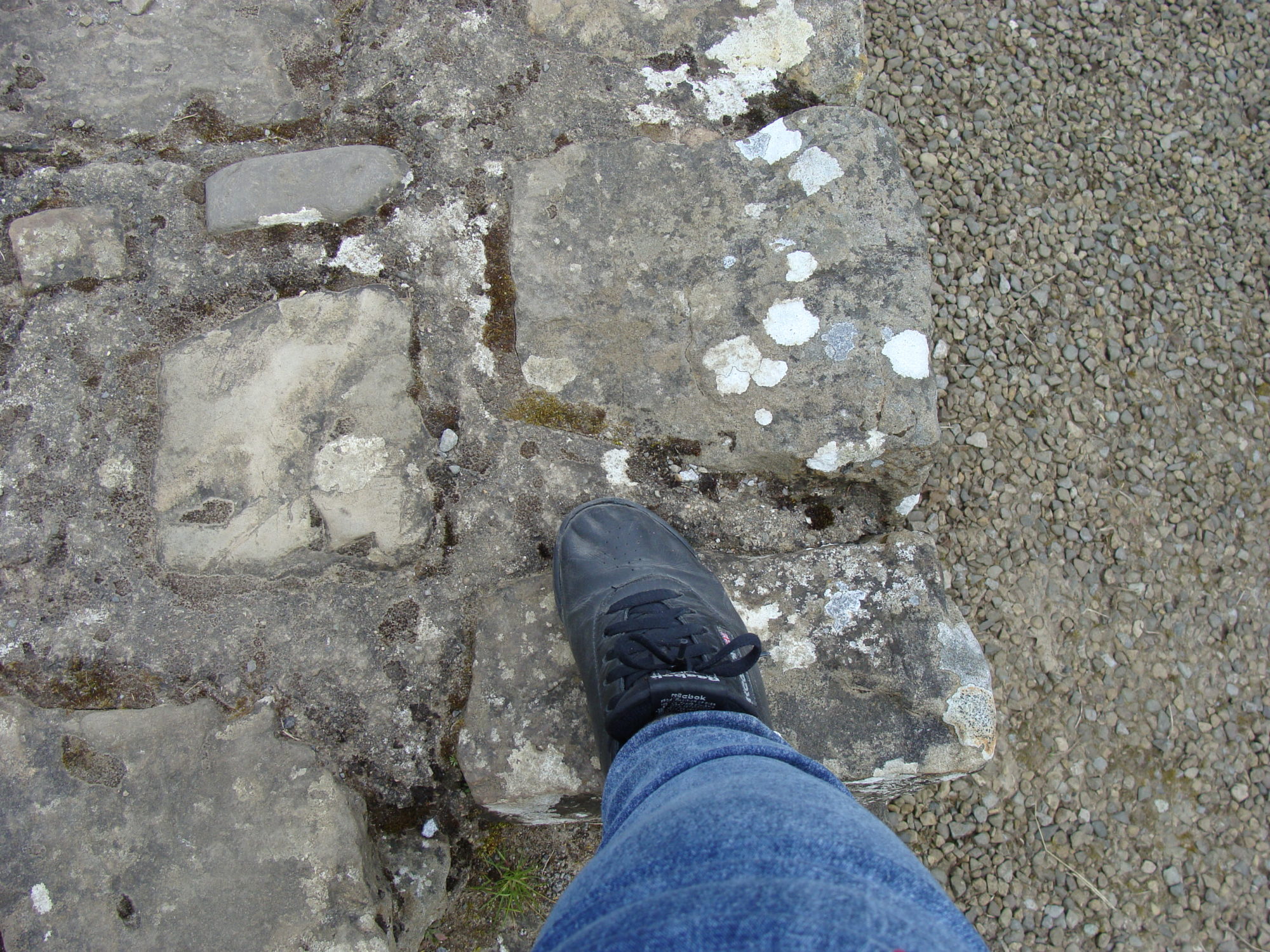
In addition to being the railway’s highest point. This was also where some of the scenes in the film Star Wars Episode V: The Empire Strikes Back were filmed. Polar explorers Nansen, Amundsen and Shackleton used the area around Finse as training grounds due to the area’s extreme conditions. This was also where I decided to take a photo of my seatmate’s foot. It was, after all, the only clear photo I could get. He gallantly offered to switch places with me. Although I still got some reflections, the level of my photography improved immediately. We did switch back later after we began to come down from the mountains. By that time, I had some good shots that I could keep and share.
Once we arrived in Oslo, we just had a short walk from the railway station to our hotel, which was the Radisson Blu. Then we needed to get our rooms. By the time I got into my room and got settled in, I was feeling like I was starting to go downhill health wise. I took some cold meds, had some dinner, and went to bed.
Next time – Post Cruise extension – A Day in Oslo
Bergen Train StationBetween Bergen and VossAlso between Bergen and VossSeatmate’s FootNear FinseAlso near FinseAnother near FinseYet another near FinseThis too near FinseStill in Finse areaSomeone’s homeFinse to HaugastolAlso Finse to HaugastolNearing HaugastolHaugastolHaugastol to GeiloAlso Haugastol to GeiloSeals on the small island
Located between the Hardangerfjord and the Sognefjord in western Norway, Bergen was officially founded by King Olav Kyrre in 1070. There was already a trading settlement there as far back as the 1020s or 1030s. By the early 13th century Bergen (Bjorgvin) had become the capital of Norway and remained so until the 1830s when Oslo became the capital city.
The afternoon excursion for which I had signed up was called Panoramic Bergen. It was a combination of riding on the tour coach and walking around to explore parts of the city more thoroughly.
Just a short walk from the ship was Håkon´s Hall. King Håkon Håkonsson built Håkon´s Hall between 1247 and 1261 as a royal residence and feasting hall. It was the first of its kind built in stone. Good thing too as the mostly wooden Bergen has tended to have a lot of fires and has burned down several times.
Standing a short distance from Håkon´s Hall is the Rosenkrantz Tower, which is regarded as the most important Renaissance monument in Norway. It was built by Magnus the Lawmender in the 13th century. The original building has been extended several times to increase the fortification of the building and to create offices for the governors of Bergen. In the 16th century it became the governor’s castle.
When visiting the Rosenkrantz Tower, it is possible to see King Magnus Lagabøte’s bedroom, the chapel with its original altar, and the room on the ground floor where the guards lived. Underneath the guardsrooms are the dungeons, which were in use until the first half of the 19th century. Up in the attic are several cannons. These were used only once in war, during the battle of Vågen in 1665.
During World War II, in 1944, the Rosenkrantz Tower was badly damaged when a cargo ship loaded with explosives blew up just outside. The upper floors collapsed and were rebuilt in the 1960s.
After a passing glimpse at Bryggen, we headed over to the Nordnes Peninsula to have a wonderful scenic view of much of the city. After taking some photos, we headed to the Nykirken i Bergen, which is the parish church of the Church of Norway in Bergen. The name Nykirken literally means “new church”. It was consecrated in 1622. The church has burned down a few times and rebuilt in the same place on the medieval foundations of the Archbishop’s Palace.
We started with the grave, just outside of the church, of a former pastor of the church who died in the early 1800s. Then we went under the church to take a good look at the old foundations.
Back up inside the church were mainly closed box pews that could seat over 750 people. Plus, there was an angel hanging from the ceiling aways in front of the altar that could be lowered by a pulley system to be just above the baptismal font whenever a baptism was performed. Composer Edvard Grieg was baptized in this church when he was a baby.
After leaving the Nykirken, we boarded the coach again and drove around more of Bergen until we got to the National Theater. The theater was founded in 1850 by Norwegian violinist Ole Bull to develop Norwegian playwrights. Henrik Ibsen was one of the first writers in residence and became an artistic director of the theater. There is a statue of Ibsen in front of the theater in the photo I have included. He looks a bit scary.
Ole Bull (1810 – 1880) was a virtuoso violinist and composer who was considered by some to be on the same level as Niccolo Paganini. Much like Mozart, he showed his talents at an early age. He was only four years old when he could play everything he heard his mother play on the violin. He was just nine years old when he became first chair in the orchestra of Bergen’s theater and was a soloist with the Bergen Philharmonic Orchestra. By the time he reached adulthood, he had also become a major sex symbol of his day. His statue stands in a park a leisurely stroll away from the theater.
When Bergen was founded around 1070, the area in which it began was essentially where the part of the city called Bryggen (Tyskebryggen) is located today. The Hanseatic League was established there in about 1350. Although the area has been burned down many times over the centuries, it has been rebuilt each time on 15th century stone cellars. Today Bryggen houses mainly museums, shops, restaurants and pubs.
The buildings visible from the water have several more buildings behind them (about 67 in all). Access to these buildings is via walkways through the buildings in front. The area behind is quite interesting – especially the museums, which give an idea of what life was like at the time in Bryggen.
Due to the likelihood of fire, there were ordinances against flames of any kind. This meant no candles or oil lamps. No heating. I would think that cooking wasn’t allowed either.
There was a hospital for lepers with a church next door. The church had a separate section for the lepers to keep them apart from the rest of the congregation.
Some of the houses date as far back as 1703 when they were rebuilt after the 1702 fire. However, there was another fire in the 1950s, so some houses were rebuilt at that time. There is a Radisson Blu hotel there. If I were to return to Bergen without benefit of a cruise ship, that might be a good place to stay.
Headed back to the ship to get packed. Those of us going on the Scenic Train Ride from Bergen to Oslo were supposed to have our large cases outside of our rooms by 10pm so they would be picked up and sent on to our hotel in Oslo. I was done by 6pm and so headed for the World Café for my last dinner onboard the ship. Sherry and Christina met up with me after a bit. They were flying home from Bergen the next morning. I still had a couple more days to go before I flew home.
Next time – Post Cruise extension – Scenic Train Ride from Bergen to Oslo
Ship docked at BergenBergenMore of BergenShip and King Haakon’s Hall & Rosenkrantz TowerKing Haakon’s Hall & Rosenkrantz TowerAnother view of BergenNykirken exteriorGrave just outside of NykirkenAround the back of NykirkenAncient door in cellarPart of cellarAnother part of cellarMore of cellarA bit more of cellarBox pewsAltar and angelA different view of BergenStatue of Ole BullNational TheaterByparkenBryggenAnother angle of BryggenWithin BryggenOne of the narrow streetsAnother section of BryggenStill another view of BryggenThe Fish Market
Our morning expedition in Bergen was called A Taste of Norwegian Farm Life. This was a small farm just outside of Bergen. Ǿvre Eide Farm on Jorval Lake was located on mountainous terrain and had some horses and sheep. They also had some buildings with sod roofs. The roots of the farm date back to the 16th century.
The first horse to which we were introduced was a Norwegian Fjord horse. It is believed that the Fjord is one of the world’s oldest horse breeds and that they migrated to Norway and were domesticated over 4000 years ago. They were used as war horses by the Vikings and have also been used as farm animals in western Norway for hundreds of years.
Fjord horses tend to be very strong and agile. They are not as small as the Shetland Pony, but they are still relatively smaller than most other horse breeds. They are always of a dun color. I felt that this particular horse and I bonded immediately since we were both small and blonde. But it could have just been because her breed tends to be quite friendly.
Another one of the girls working at the farm brought a lovely Shetland Pony by to say “hi”. He was 30 years old and still looked quite healthy and youthful. He was taken to an area where he could hang out on his own for a while outdoors.
The last horse to which we were introduced was a Dole horse. This is a Norwegian horse breed that was likely descended from the Friesian. The breed is used mainly for agricultural purposes. I thought this particular fellow was quite handsome with his braided mane.
After being introduced to the horses, we were taken to meet some sheep. These were Spælsau sheep which consist of roughly 22% of the sheep in Norway. They are a Norwegian breed that has been domesticated since the Iron Age.
This sheep breed gives both milk and meat of good quality. The wool has two layers. The underlying layer keeps the sheep warm while the outer layer helps protect the underlying layer against the wind and rain. The wool from Spælsau sheep, which is long and glossy, tends to have a beautiful shine. It was used in old Norwegian tapestries during the Renaissance and Baroque periods. Viking ship sails were also made from Spælsau yarn. In clothing it is light, stable, and absorbs very little moisture.
The sheep were much more interested in the food the girls were offering them than in us. One of the males was apparently quite dominant and tended to butt the others out of his way. Their interaction was fun to watch.
After watching the sheep being fed, we were taken to an indoor area often used for weddings. Here we were given some fruit juice as a greeting. I had raspberry. Then we were seated and fed some almond pralines and some pastries with berries and cream while sipping coffee, tea or hot chocolate.
After we had our fill, a couple of the girls showed us their traditional national costumes. These were called “bunads”. The color and style of the bunad was based upon where the mother of the girl was from. Each one is specially made for the female, in Norway, of Norwegian materials, and is supposed to last a lifetime.
When we returned to the ship, we had about 45 minutes before I needed to leave for the afternoon excursion. But I was feeling pretty full from the pralines, pastries, raspberry juice and hot chocolate, so just had a small salad before heading off from the ship again.
I was really liking this part of Norway. It was around in this area and a little further north that my Norse Viking ancestors came from. I have always loved mountains and water. Put me in a location with a mountain on one side and a lake, river or sea on the other and I am content. Up until this point I had felt that it was most likely from my Scottish, Welsh and Swiss ancestry. But obviously, the Norse ancestry has a part in it too.
Next time – Touring Bergen and Bryggen
BergenMore of BergenOur ship docked in BergenSod roof at Ǿvre Eide Farm Fjord horseShetland ponyDole horseFarmhouseViewSpælsau sheep coming to greet usSheep ignoring usAsking for foodContentedly eatingFarmhand with helperMore of the farm buildingsAdditional farm buildingsThe building for receptionsView from insideNational costumesBunadsCloseup of Shetland pony
I met my first Shetland Pony when I was at Texas A&M University at Commerce. My now ex’s grandmother had a small cattle ranch not too terribly far from school and he and I went out there to spend some time with her. In addition to the small herd of cattle, she had two horses. One was a beautiful female chestnut who technically belonged to my ex. She was not very impressed by me. It seemed to me that she thought of me as a rival. I remember her name as being Suzie.
There was a male Shetland Pony there as well. He was quite friendly towards me. While my ex rode around on Suzie, the Shetland and I hung out together. He was the perfect size for me to ride, as I am small in stature and would sometimes struggle a bit with a full-sized horse. Shortly before high school graduation I had been on one who took off with me before the stirrups could be properly adjusted and I had ended up bouncing off of him. I wasn’t seriously injured, just cuts, sprains and bruises. I spent graduation day with bandages and wraps beneath my graduation gown.
I had a child-sized bicycle and a child-sized guitar, so why not a child-sized horse? This Shetland was very affectionate and seemed ready to go home with me.
On one of my visits to the Isle of Skye in Scotland a few years ago, a couple of Shetlands trotted over to me to say “hello” when we stopped up on a mountain to take some photos of the gorgeous scenery from there. They too were very sweet and friendly.
Small ponies have existed on Shetland for more than 2,000 years. They are thought to have been in domestic use since the Bronze Age (between 3500 and 1200 BC). They are very hardy animals who were developed to withstand the harsh climate, rugged terrain, and scarce food. They were first used to haul peat and seaweed and for plowing land. They can easily live for more than 30 years.
Shetland ponies have short, muscular necks, compact bodies, and short, strong legs. They have small heads with wide-set eyes and small, alert ears. Their coats can be any color except spotted, but black and brown are the most common. In the winter, they grow a thick double coat to withstand the cold.
Shetland ponies are known for being friendly, good-natured, and confident. However, they can also be opinionated and headstrong, which can make them challenging for some owners.
Currently Shetland ponies are used for a variety of purposes, including working and recreational riding, dressage, show horses, and driving with small carts.
After having some lunch onboard the ship, we headed out north of Lerwick this time. Some photos of the scenery were included in the post titled “Fascinating Shetland” as I wanted to have just Shetland Pony pictures with this post. The Tingwall Valley, with its Norse heritage, and Girlsta, with its beautiful lochs and hillside scenery, plus Whiteness and Wormdale were some of the areas through which we traveled. We also stopped at Scalloway to take a photo of the castle there.
The Shetland ponies at the location where we stopped to hang out with a few of them didn’t seem to be all that interested in us. It was mid-afternoon and they had been greeting tourists for several hours by that point. So they just went on about their business while we watched them interact with one another and listened to their owners talk about them. I was imagining their conversations with each other about our group. “That one seems nice.” “That one has no fashion sense. Doesn’t she realize that those colors clash?” “Don’t you want to get petted?” “No. I’ve been petted quite enough today. Thanks.” “If one more person tells me what a pretty little horsie I am, I just might barf.”
I took loads of photos, not only for myself, but also to share with one of my sisters-in-law who had owned a delightful horse named George and is still very much a horse lover. I have to agree that they are wonderful animals. Highly intelligent, with clearly individual personalities.
During some free time out in the wilds of North Mainland, I went for a good walk in the area of a golf course. There were some men fly fishing in the river nearby. The afternoon wasn’t near as cold as the morning had been. It wasn’t raining either. So a very pleasant time out in the countryside before heading back to the ship. The following day I would be visiting Norway for the first time since some of my Norse ancestors moved down from a little north of the Bergen area to Orkney in the 10th century.
When Sir Walter Scott visited the site on Shetland in 1814, he called it “Jarlshof” based on it being the “laird’s house”. This was prior to the storm that unearthed some of what was beneath and surrounding the remains of the laird’s house. Once excavations began, it was discovered that the history of the site dated back as far as 2500 BC. It includes Neolithic remains, Bronze Age houses and a smithy, an Iron Age broch and some houses, Pictish wheelhouses, a Norse settlement including a longhouse, a medieval farm, and the remains of a 17th century castle.
I found that I could actually walk around amongst all of this. I could also touch the walls and actually needed to duck to get inside of some of the buildings – unusual for me.
In a place like this where we were in a limited area, I knew what time to be back at the coach (and knew where the coach was parked), and we had listening devices for the tour guide’s commentary, I could wander away from the group to take photos and explore. That way my back stayed happy as I kept moving and I could get my photos without having loads of others in them or competing with me for them. I could still hear what the guide was saying and could keep track of where they were in case I needed to go back there to see something special they were pointing out. I am sharing 27 photos with this post, but I took 74 photos of Jarlshof (176 total of Shetland).
The earliest finds so far have been Neolithic (2500 – 1500 BC). This was at the end of the same time period as Skara Brae (3180 to 2500 BC). The remains of one oval, stone-built structure has thus far been uncovered from the Neolithic period. In the photos I have included here of that time period, you can see what looks like a stone inside of a stone near an upright stone in the second and third photos. This is a trough quern, used for grinding barley and wheat.
There are three distinct Bronze Age houses at Jarlshof. They are from roughly 2000 to 800 BC and are smaller than the houses at Skara Brae. Otherwise, they are quite similar. People were raising sheep and cattle at this time. They also had access to fish, shellfish, wildfowl and seals. A skeleton of a dog was found just outside one of the houses. Evidence at the smithy (who moved in about 800 BC) indicates that axes, knives, swords and pins were produced there. A bronze dagger was found at the site. The Bronze Age trough quern was smaller than the Neolithic one had been.
The Iron Age settlement was partially built on top of the Bronze Age settlement. This was at about 500 – 300 BC. Internal piers were much lighter than the thick buttresses from the Bronze Age, which gave more space inside of the houses. The style was still of cells radiating out from a central hearth and was entered via a paved passage from the seaward side.
By the Iron Age, the trough quern had been replaced by a saddle quern, which was much smaller and lighter than the trough quern. You can see a saddle quern in the sixth photo I have included here in roughly the bottom left of the photo.
In addition to having better tools, spindle whorls and weaving tools found here indicate that fabric weaving and spinning was increasing. In addition to the sheep and cattle, evidence has been found that people were keeping pigs, dogs, and small ponies.
New underground storage areas for perishable food have also been found there. There isn’t any access to visitors to the large Iron Age souterrain. It is at the end of a long, narrow passage and is actually underneath the visitor pathway. But I took a photo of a smaller one from a Pictish wheelhouse. It is the 21st of the 27 photos I have included here.
The broch, which was a fortified dwelling, was built during the late Iron Age (100 BC- 100 AD). Part of the broch was lost to the sea. It is thought to have been originally 13 metres (40 feet) in height. It was exciting to me to be able to walk around inside of the remains of an actual broch. I also explored what remained of the stairs within the walls (see the 26th photo).
The broch was encircled by the wheelhouses. There were four of them. These were built by the Picts from about 200 – 300 AD and were lived in until around 800 AD. I had never seen anything like the wheelhouses before, much less be able to walk around inside of them. I found them to be quite amazing. Many of the wheelhouses that I explored still had a good portion of their roofs. Since I was mostly alone in them, I felt very much like I was transported back in time. Being in out of the wind was helpful too as it was a very chilly, damp wind, right on the edge of the sea as we were. The passages into the wheelhouses tended to curve, so I wasn’t feeling the wind smacking against me much until I came back out of the entrance.
The Norse settled at Jarlshof in about 850. It was quite easy to see the remains of a Viking longhouse (9th photo). The farmstead lasted for about 12 to 16 generations and had been replaced by a farmhouse (8th photo) to the east by the late 1200s (about 1275). This included a barn and grain kilns.
Once Shetland became part of Scotland in 1469, it came under the control of Earl Robert Stewart, the illegitimate son of King James V of Scotland in the 1500s. He converted a medieval stone farmhouse into a fortified house in the 16th century. His son, Patrick Stewart, who by all accounts was not a nice guy, made changes to the property, turning it into a castle, in the early 17th century. By the late 17th century, it was abandoned. Although Sir Walter Scott named the site after the “Jarlshof” or earl’s house in his novel The Pirate. Its proper name is Sumburgh, from the Old Norse “borg”, meaning fort.
Since I was so far ahead of most of the group, even with all of the photos I was taking and exploring I was doing, I found I had plenty of time to not only check out the exhibits and the gift shop at the visitor’s center, but to also get some hot chocolate with Bailey’s at the hotel where the coach was parked.
Despite the fact that real Vikings did not wear helmets with horns on them, I couldn’t resist buying a knit helmet with horns to wear in the frosty winters at home at the gift shop. I also got a Viking ship Christmas tree ornament.
Jarlshof is another place I would be more than happy to visit again. I would also like to spend more time in Lerwick, and check out the puffins and other cool birds at Sumburgh Head lighthouse. Also, is it possible to go out to the island of Mousa and venture inside of that broch?
Next time – Shetland Ponies
Approaching JarlshofNeolithicNeolithicBronze AgeBronze AgeIron AgeIron AgeMedieval FarmNorse SettlementNew Hall & Laird’s HouseView from towerEntrance to a WheelhouseAnother View of New Hall & Laird’s HouseWheelhouse InteriorAnother View of the InteriorEntering a WheelhouseExiting a WheelhousePart of a WheelhouseAnother Part of a WheelhouseJust Outside of a WheelhouseA Storage Area of a WheelhouseA Roofless WheelhouseA Detail of the Roofless WheelhouseRemains of BrochAdditional Remains of BrochRemains of steps Within Wall of BrochTower of Laird’s House from Broch
Shetland was a place that I had never visited before and was one of the reasons why I wanted to do this particular trip. I didn’t know a lot about Shetland other than what I had seen on the British television series called “Shetland”. It seemed like a pretty interesting place.
Close to where our ship was docked was the Northlink Ferry. This is an overnight ferry that operates between Aberdeen and Lerwick or Kirkwall (Orkney) and Lerwick. People can take their vehicles and even their pets with them and spend the night in a cabin, a sleeping pod, or just a reclining chair. There is a restaurant, a bar, and a cinema.
Once on the tour coach, we drove through Lerwick to see the Capitol of Shetland. The first place of interest was Fort Charlotte. The fort was built back in 1665 to protect the Sound of Bressay from the Dutch during the Second Dutch War. It did hold off the Dutch fleet in 1667 even though the walls were unfinished and there were few guns. But it looked more heavily manned and armed than it was. It was burned out in 1673 during the Third Dutch War. More than a century later, it was rebuilt during the American Revolution, but never saw any military action. Fort Charlotte is an artillery fort with roughly five sides and is presented as it would have looked in the 1780s. It is currently the base for Shetland’s Army Reserves.
We next encountered the home of fictional character, Jimmy Perez, in the “Shetland” TV series. The name of the place is The Lodberrie and is likely the most photographed place in Shetland. The series is based upon books written by the same author who has written the “Vera” books, Ann Cleeves. This building dates to about 1772 and is the last of 21 lodberries lining the foreshore in Lerwick by 1814. They were built with their foundations in the sea and were essentially trading booths, selling the legal goods from the street side shops. Illegal goods were taken into a maze of tunnels running under the streets to bypass the customs men.
The Town Hall has been seen frequently in the series. In the first series, it is where the Up-Helly Aa festival begins. This is an annual festival inspired by the Vikings that takes place on the last Tuesday of January. It consists of a parade of over 1,000 men dressed as Vikings and carrying burning torches. It ends with setting fire to a replica of a Viking longship.
Across the street from the Town Hall are the Court Buildings and Police Station, in both real life and on the TV show. In real life, however, crime is really low in Shetland and serious crimes are quite rare.
Radiating off from the main streets are very narrow lanes called the Lerwick Lanes. Many of the homes, pubs and restaurants seen in the series are located in these lanes.
As we passed the Tesco and headed out of town, we encountered Clickimin Loch and Clickimin Broch. A broch is a circular stone tower built by the northern Caledonian tribes between 400 BC and 100 AD. They are unique to Scotland and are the tallest prehistoric structures in the British Isles. This particular one doesn’t have all of its levels intact but has a pretty decent circumference.
Next we passed a peat bog (several of which are featured in the series) and then had a photo stop for the Mousa Broch. This broch stands on an uninhabited island and is the tallest broch in existence. Its walls are the thickest of any broch yet discovered, but it has the smallest diameter. Perhaps that is why it has survived intact. In the photo, the broch is near the center.
On our way to Sumburgh Head, we passed another location that figured quite prominently in Series Three of the “Shetland” TV series. It was a grouping of abandoned buildings out in the countryside.
At this point, we encountered an anti-littering road sign in the Shetland dialect. Since Shetland was once part of Norway, the dialect seems to have bits of Norwegian as well as bits of Scots Gaelic, Scots and English. I felt the sign’s message was quite clear in its intent.
To get to Sumburgh Head from there, we needed to drive across the runway of Sumburgh Airport. Yup. The road actually crosses the runway. It was rather foggy and raining quite a bit by that time. My photo of crossing the runway shows the raindrops on the coach windows. A plane had landed just before we arrived, so no collisions. Shortly after we crossed the runway, I could hear a helicopter approaching. But the fog was too thick to see it until it got much closer to the ground. Fortunately it didn’t need the runway. It had its own area in which to land and we were far enough away to not cause any problems there either.
We were headed for Jarlshof, to which I have dedicated its own post. Near Jarlshof and visible from it once the rain and fog cleared was Sumburgh Head. This was another location that figured quite prominently in Series Three of “Shetland”. Both the lighthouse, which was built by the grandfather of Robert Louis Stevenson in 1821, and a café that stood in for a hotel were featured in that series. The six episodes of that series were quite spellbinding, both when it came to the characters (and actors playing them) and the locations used.
The afternoon excursion mostly consisted of seeing Shetland Ponies (also with their own post). But on the way there and on the way back to the ship, we saw the landscape of the northern portion of the Mainland island.
Along the way to see the ponies I spotted a crannog. Crannogs were built throughout Scotland, usually in freshwater lochs. In Shetland however, just over half the crannogs were built in coastal waters and all were built during the Iron Age. The crannog is what lies underneath as opposed to the building on top. In the photo, the crannog is in the water to the right.
Crannogs are little islets that are partially or completely artificial. They have been built up with rocks in order to be sturdy enough for a dwelling to be built on top. Most of the buildings were wooden and so no longer exist. The bridge out to the crannog was also wooden. A crannog tends to have a relatively unique look to it and so is fairly recognizable to someone who has seen others. Since I have seen them all over Scotland on previous visits, I have learned to recognize them.
Before returning to the ship, our last stop was for a photo at Scalloway. Scalloway was the former capital of Shetland up until 1838. It has been inhabited since Neolithic times and is only a mile or so from the Viking and Norse parliament site, Ting site, in the Tingwall Valley. The village has a population of about 1,200 and the remains of a castle, which also played a part in the” Shetland” TV series – in Series Five, which had to do with a ring of people traffickers.
Next time – Jarlshof
Northlink overnight ferryA glimpse back at our shipFort CharlotteLerwick Town HallCounty Buildings Sheriff CourtRoad SignJimmy Perez’s HouseClickimin BrochPeat BogMousa Broch (center)Some Shetland sheepShetland TV series setting (third series)South MainlandSumburgh AirportPlane arrivingCrossing runwayFreshly arrived helicopterSumburgh Head LighthouseNorth MainlandChurch and graveyardCrannog (in the water)Remains of croftMore of North MainlandScalloway