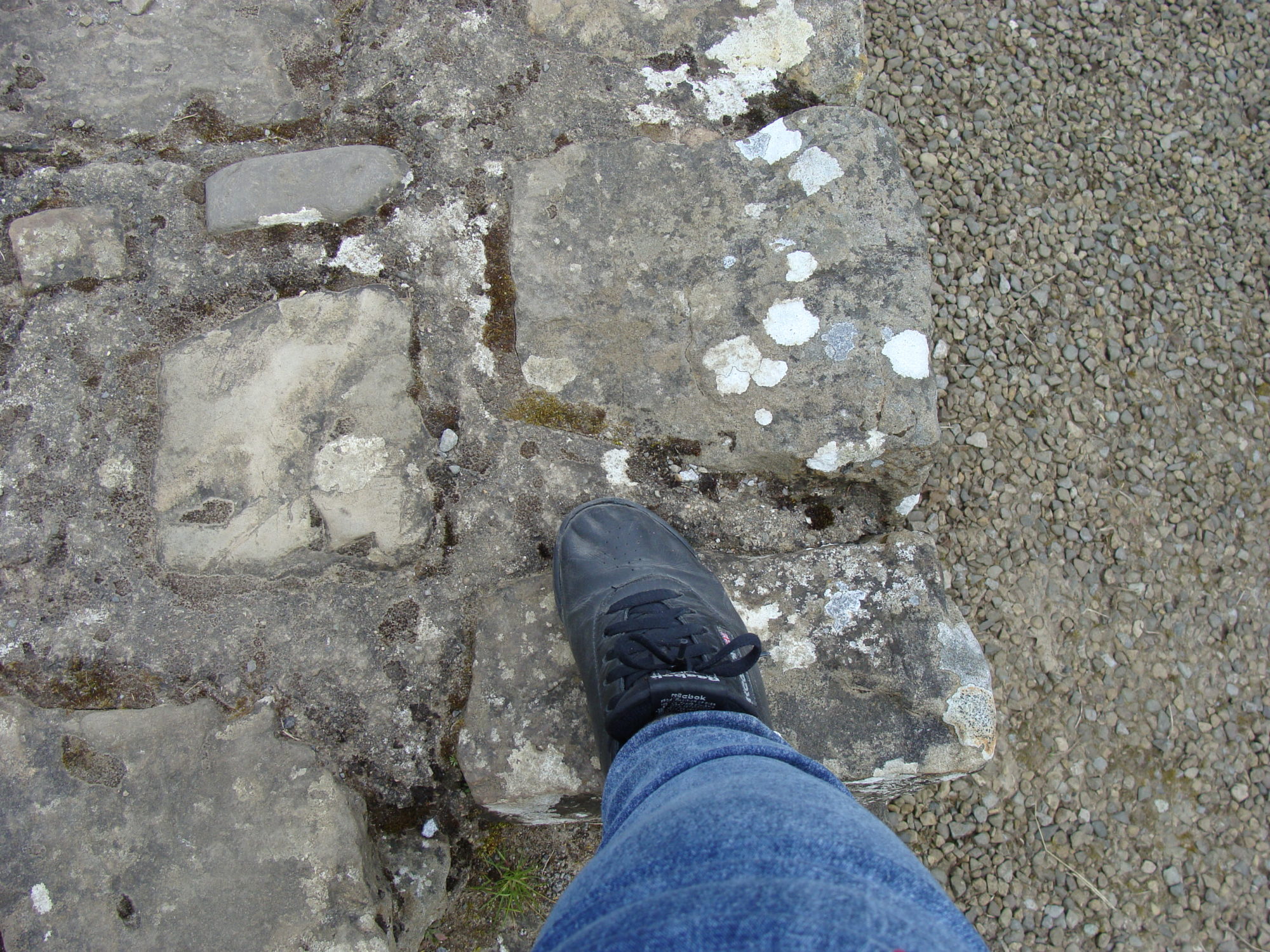
Delphi, Apollo & the Oracle

The origins of Delphi are found in the mists of myth. Several myths are involved. One says that Zeus released a couple of eagles, one from the east and one from the west to see where they would meet. Pythos (later Delphi) was the spot. So it was declared the “belly button” or center of the world. The belly button stone can still be seen.

Another myth was that Apollo, while still a toddler, slayed a python (serpent or dragon) that served Gaia, the Earth Mother. He then took Pythos over, renamed it Delphi, and had a temple created there that he considered to be his main home. Whenever he wasn’t there (usually for a period of time in the winter), his pal Dionysius hung out in his place.

Ancient Delphi’s location is on one of the slopes of Mount Parnassus. The location is quite amazing and its rediscovery was equally amazing. When the Ottomans took over in the 1400s, Delphi had already been abandoned for roughly a thousand years, after having been shut down by the Roman Emperor Theodosius I in 381 during the persecution of the pagans. It was during the time of the Ottomans in the late 15th or 16th century, however, that Delphi was built over and became the village of Kastri.

In the 1700s, interest in Delphi began once folks realized that it had been a real place, not just a mythical location. But, in the early 1800s, when it became apparent that Kastri was built over the remains of Delphi and that the village would need to be removed to allow for any excavation, the villages decided they weren’t going anywhere. But, after a massive earthquake in the late 1800s, the villagers were offered new homes in another (but similar) area on Mount Parnassus, not far away. So the village was relocated and excavations began. Our tour group spent the night in a small hotel in the village, and then headed over to explore Delphi the following morning.

We entered through the Agora, which was the main gathering place. It didn’t take long before we found ourselves staring right at the belly button stone. It was an outie. Nearby were some bases where some of the statues had stood. The footprints of those statues could still be seen. Delphi had eventually taken over from Olympia as the main site of various athletic events that ultimately became the Olympics, so numerous athletic statues had originally lined the route up the mountain.

 The remains of several treasuries came next as we wound our way up towards the Temple of Apollo. These were built by various city-states to hold their offerings to the gods – mainly Apollo. The Athenian Treasury had been mostly restored by the time of our visit in 2014.

A few steps from this treasury was the Sybil Rock. This was where the oracle who existed prior to Apollo’s temple sat and gave her prophecies. Delphi had been a center for oracles and prophecies from the days of Gaia and the Python. The Sybil oracle would go into a trance to give her prophecies much as the later oracle.

Once Apollo took over, a special room in the temple held the oracle, who sat on a tripod and breathed fumes coming up through a crack in the rock floor beneath her. These fumes were said to be emitted from the decaying body of the python slain by Apollo. The temple remains were from the sixth one built on the site and was completed in 320 BC. It was destroyed by zealous Christians in 390 AD. But the original foundation wall remained.

The Temple of Apollo was roped off and there were security people around so that tourists could not go up onto the remains of the temple floor. There was a fair amount of it missing, so I’m sure it would be dangerous to anyone who wasn’t really careful about what they were doing. But, boy did I want to go up there and check it out.

Our guide and I worked out the location where the oracle would have been from a spot above the theatre where we had a pretty decent view of the temple. My video camera could zoom in pretty close, but my photo camera not so much. That part of the floor was still there and had a very distinctive crack in it. The theatre dated to the 4th century BC.

Further up Mount Parnassus, near the top, was the stadium where the various athletic games took place. The Pythian Games and the later Panhellenic Games were held every four years. The track and field sports took place in the stadium. It was quite a hike. Fortunately the trail zigged and zagged its way up gradually. So, with my cane and an occasional stop to catch my breath, I could make it.

The museum, back down on more level ground, not far from the entrance to Delphi itself, contained lots of statues, pieces of friezes and other artifacts found on site. I loved seeing some Corinthian helmets much like the replica I have on a bookcase in my living room at home.

Then there was The Charioteer (478 BC). I had seen photos of this statue in books my entire life. It is considered to be one of the greatest ancient Greek statues ever created. There I was taking my own photos of it. It survived because it was buried during an earthquake. Nobody knew it was there until it was found during excavations. It was life-sized and made out of bronze.

After lunch, we visited a tholos (a round temple), which is about a half mile from the main part of Delphi. Although there were other ruins there, the Temple of Athena Pronoia (built 380 to 370 BC) was the main site to see. It was gorgeous as was its setting.

The following morning, we drove along the Gulf of Corinth to get from western mainland Greece to the part of Greece called the Peloponnese over a bridge called the Nakpaktos. Just the other side of the bridge was Patras. Our destination was Olympia.

En Route to Meteora

After leaving Athens, we encountered Marathon 26 miles away. In 490 BC the heavily outnumbered Athenians beat the Persians at the Battle of Marathon just 10 years after the Persians wiped out 300 Spartans and 700 Thespians at Thermopylae. A runner was sent from Marathon to Athens to bring the news of victory. Legend is that he collapsed and died after delivering his message. If that was the case, it makes me wonder why anybody would decide to commemorate those 26 miles on a regular basis. During both the 1896 and 2004 Olympics, Marathon was the starting point for the men’s race and also for the women’s race in 2004. The photo I have included is the plain of Marathon where the battle took place. The burial mound there contains those who fell during an earlier battle there against the Persians.

We also passed Theva (sometimes called Thebes), which was where the story of Oedipus took place. Oedipus is the guy who blinded himself once he discovered that he had fulfilled a prophecy saying he would kill his father and marry his mother. Complicated little tale there. Nothing of the ancient times was still there, so not really anything of interest to photograph.

After lunch, we passed Thermopylae, where the Spartans faced the Persians. It is said that roughly 300 Spartans and 700 Thespians stood their ground at a narrow pass against 100,000 to 150,000 Persians. A very interesting film called 300 was made in 2007 starring Gerard Butler as the Spartan King Leonidas. More about that later when we actually made a stop at Thermopylae. Back in 480 BC, the terrain was totally different. The coastline was considered to be basically where the highway is now.

We also passed Mount Olympus and could see it clearly. This was the tallest mountain in Greece and considered to be the home of the ancient Greek gods and goddesses.

We continued on to Meteora to spend the night at a town called Kalambaka. I could see a convent (St Stephan) up on a rock formation from the balcony of my room. Had dinner with Kevin, Bronte, Barbara, Roberta and Chris.

The convents and monasteries were all built high up on rock formations back mainly in the 1500s in the part of Greece called Thessaly, which is near the border with Macedonia. Our first visit was to Convent Rousanou/St Barbara, built in 1560. We weren’t allowed to take photos inside and were only allowed in the church, which was completely covered with frescoes. Women had to wear skirts, so we were given material to tie around our waists as most of us weren’t wearing skirts. It had some lovely gardens.

At Monastery Varlaam across the way, we were allowed inside of the church, wine storage, museum and former hospital. We also had a great view of the convent from there. And yes, we walked all the way up and down the rock formations to get to them. Greece was my mountain tour. Everything was up or down a mountain – usually a very steep mountain. All together there are four monasteries and two convents still in existence out of the original twenty four.

The Holy Trinity Monastery is the most difficult to get to and was featured in the 1981 James Bond film For Your Eyes Only. Its setting was amazing. We went back down into the town to visit a place where icons were made before having lunch.

After lunch we returned to Thermopylae so we could take some photos of the area and of the monuments dedicated to King Leonidas and the Spartans who sacrificed their lives there. The Spartans knew they were outnumbered and didn’t stand a chance of winning, but believed they could rally the rest of Greece to join the fight against the Persians if they could just hold them off for a while with courage and dignity. They did. They held them off for three days until they were betrayed and the Persians were shown a back trail by which they could surround and slaughter their enemy.

We were let off of the tour coach on the right side of the highway. This is where the modern monuments to the Spartans and the Thespians are located. This was also where the sea was back in 480 BC. On the left side of the road was where the battle itself took place.

There is a monument at the top of Kolonos Hill (the burial mound of the Spartans). This dates from the 1950s, replacing a much earlier monument. There has been some sort of monument there since the time of the battle. To climb up there, knowing that the remains of the Spartans were beneath my feet was quite something.

Back across the road, I read the English translations of all of the monuments and took several photos of the statue of Leonidas. My favorite is the one taken from behind where he is facing the mountains and where the pass would have been.

Next time – one of my favorite places in the world, Delphi.

Athens

In early May of 2014, I took a 16 day trip to Greece – the first eight days would be on the mainland and the last eight would be on a cruise of the Aegean. The tour would start and end in Athens.

Athens is one of the world’s oldest cities with evidence of human habitation dating back as far as somewhere between the 11th and 7th centuries BC and recorded history spanning 3,400 years. Named for the goddess Athena, classical Athens was a very powerful city-state. Eventually it became the leading city of all Greece.

Once I arrived in Athens, I was picked up by a driver at the airport. When we got to central Athens, the traffic was insane and the driver continually crossed himself as he drove. On the one hand, it was humorous, but on the other it was necessary. To keep from having multiple mini heart attacks, I kept my eyes on the driver and off of what the other drivers were doing. I also said several prayers.

Due to various delays in flights on the way, I didn’t get to the hotel (which was near the Acropolis) until a quarter to 6pm with the tour group meet and greet at 6pm. I basically just got into the room and opened my cases for the contents to breathe before I headed back downstairs.

Met Kathleen, Leslie and John during the gathering and Ivy and Heather after. All six of us walked to a nearby grocers to get some bottled water and snacks for dinner so we could spend our time getting ready for the following day and then get a good sleep. We wanted to be fully awake for our day in Athens.

We began our tour at a former palace (built in 1843) which became the Hellenic Parliament in 1934. In the square in from of the parliament is the Tomb of the Unknown Soldier. The tomb is guarded by the elite Presidential Guard. I love their uniforms, so I managed to shoot a quick photo out of the window of the tour coach.

The Academy of Arts & Sciences looks like an ancient Greek temple. We also took a look at Athens University and the National Library. Then we swung by the Acropolis. We found that the site was not yet open for business, so we visited nearby Mars Hill instead.

Mars Hill is the Roman name for the Hill of Ares; Ares being the Greek god of war and Mars the Roman version. This was the location of Ares’ trial by the other gods for the murder of one of Poseidon’s sons. It was also where Paul preached about the “unknown God”. It still has its ancient, original stairs in addition to a more modern staircase at another part of the hill. It also has some great views of the city.

Also viewed from Mars Hill (known in Greek as Areopagus) is the ancient agora (marketplace) of Classic Athens. The agora is a very large area with bits and pieces of various buildings and memorials, including a mint, an Odeon (theatre) and several temples.

Before returning to the Acropolis, we visited the Panathenaic Stadium, which was originally built in roughly 330 BC for the Panathenaic Games, which took place every four years. It is the only stadium in the world built entirely in marble. It was largely abandoned after the rise of Christianity in the 4th century AD and finally excavated in 1869. For the first modern Olympics in 1896, it was used for the opening and closing ceremonies and for four of the nine events. It continues to be used as a stadium and as the place in Greece where the Olympic torch is handed over to the hosting nation of the Olympic Games for that year.

When we could finally visit the Acropolis, we gathered at the part of the base from which we could see the Temple of Athena Nike (427 – 424 BC) looming over us from above. Instead of the main entrance, we went up a narrow road with steps here and there that rose up towards the Temple of Athena Nike. Nike means victorious.

I really liked coming up an ancient road and steps from the side of the Acropolis instead of the main entrance. It was a different experience and allowed us to see the Odeon of Herodes Atticus (161 BC) on our way up as we passed right next to it. We came off of the road just below the Temple of Athena Nike and so were able to enter through the Propylaia (the monumental gate, 437 – 432 BC). This gate controlled (and still controls) entrance to the Acropolis.

Evidence has been found of the existence of Mycenaean structures on the Acropolis in the late Bronze Age. Between then and when the current structures were built, numerous temples and other buildings were constructed.

From 460 to 430 BC, the Parthenon was constructed as a temple dedicated to Athena. It replaced an earlier temple that had been destroyed by the Persians in 480 BC. At the end of the 6th century AD, it was converted to a Christian church dedicated to the Virgin Mary. During the Ottoman conquest in the 1460s, it was converted to a mosque. Its destruction came in 1687, when ammunition kept inside was ignited by Venetian bombardment during the Siege of the Acropolis. In the early 1800s, the Earl of Elgin carried much of the surviving sculptures away to Britain, supposedly with the permission of the ruling Ottomans. Restoration began in 1975.

Across the way was the Erectheion, built in 421 – 406 BC and dedicated to Athena and Poseidon. Mythology indicates that the structure enclosed both the mark in the rock made by Poseidon’s trident and the olive tree planted by Athena during the contest between them as to who would be the namesake of the city. A salt water well and tombs of some of the ancient kings were also on this site and enclosed within the building.

On the south side of the building is the Porch of the Caryatids. These are columns in the shape of women.  Five of the six originals are in the Acropolis Museum while the sixth was taken by Lord Elgin to decorate his home. It was said that the remaining five, when they were still in place at the Erectheion, would wail at night because they missed their sister.  Reproductions of all six Caryatids stand in place of the originals.

Over at the side where our hotel was located, we looked over the side to see our hotel, the Acropolis Museum, and the Theatre of Dionysius (6th century BC) as well as some other ruins.

Next time — Marathon, Thebes, Mount Olympus, Meteora, and Thermopylae.

From Jackson Hole, WY to Salt Lake City, Bryce Canyon, Zion National Park , back to Las Vegas

On the way from Jackson Hole, Wyoming to Salt Lake City, we took our morning break in Afton, Wyoming. Afton is a very small town known for having the largest arch made from elk antlers in existence.

In Idaho, we made a stop in Montpelier. In 1896, Butch Cassidy and his Wild Bunch robbed the bank in Montpelier. I took a photo of the plaque commemorating the heist. The gang took the money supposedly to spring one of their members from jail. Most of them managed to abscond with the money, but one of the gang was captured and held in prison until 1912. Nearby was Bear Lake. We drove through Logan Canyon to Logan, Utah to have lunch.

When we arrived in Salt Lake City, we took a tour of the Capitol and Temple Square. We could go inside of the Tabernacle, but not the Temple. Non-Mormons are not allowed inside. We could take a look at a model of the Temple, however. We had dinner at the Roof Restaurant that was in a hotel near the Temple Square and had a great view of both the Temple and the Tabernacle.

On our way to Bryce Canyon the next morning, we took a morning break at Scipio, Utah, which had a petting zoo. I made some new friends with several bunnies and baby goats. There were some Ostriches on hand which I was quite content to look at through the fencing. I had once had an experience with an Ostrich back in Texas when I was growing up who was just a tad too friendly.

Then I joined an interesting trio – an Ankole-Watusi (a type of cattle), an Alpaca, and a Peacock. The Ankole-Watusi seemed like he was much more interested in a nap than in people. The Peacock strutted around making noises but did not spread his tail feathers. The Alpaca was just plain adorable. The face was so cute, what with long bangs sweeping across his large, long-lashed eyes.

We made a stop at Red Rock Canyon and took photos of the Salt and Pepper Shakers. We continued on to Ruby’s Inn at the entrance of Bryce Canyon to have lunch. We were also staying at Ruby’s Inn for the night. We hiked into Bryce Canyon to see Bryce Point, Inspiration Point and Sunset Point. A couple of us also went part of the way down the Navajo Trail. We knew that we would have to come back up that same trail at some point and that it was steep, so we only ventured as far as we figured we could return from without giving ourselves heart attacks. Bryce Canyon was really beautiful.

The next day, we went to Zion National Park. The tour coach could only go as far as Zion Lodge. From there, we took a tram to what was called the Temple of Sinawava. I chose to hike the Riverside Trail, which was about a mile long. The temperature was about 102° F. Fortunately the Riverside Trail was relatively level and even had some good shade in places. I had a couple water bottles with me (one for going in and one for coming out) and managed to finish them both by the time I returned to the tram pickup point. Back at the lodge, I had some ice cream and downed about three more bottles of water back on the coach.

We stopped off at a Subway Sandwich shop to pick up lunch to eat along the way while crossing the Mojave Desert. The temperature there was about 112° F. We did take a pit stop along the way and it was like trying to breathe in an oven. It was even hotter than Egypt had been in September/October of 2008.

When we got back to Treasure Island in Vegas, we had a farewell dinner before getting repacked to fly home the next day and into bed. Repacking for the plane home was an adventure due to all of the Native American items I had purchased along the way. But I managed and it all arrived safely with me back in Minneapolis. It helped that I had packed some bubble wrap which I then used on the Kachinas (two of them) and the bowl of the peace pipe. The Lakota breast plate and the horsehair and bead dancer’s bustle I got in Jackson, packed pretty well since they were relatively flat. Also had several pieces of jewelry purchased in Monument Valley, the Black Hills, and Jackson which I placed in plastic sandwich bags I brought with me and tucked in among my clothes.

Next time – a 2014 trip to Greece and the Greek Islands, where we spent 8 days on the mainland of Greece and 8 days on a cruise in the Aegean.

From the Big Horn Mountains, to Shell Falls, Cody, Yellowstone, the Grand Tetons and Jackson Hole, Wyoming

The Big Horn Mountains in northern Wyoming and southern Montana have a long Native American history. They have been home to the Shoshone, Crow, Cheyenne, Arapaho, and Lakota. The Medicine Wheel in the northernmost area of the mountains is considered to be quite sacred.

It was in the Big Horn Mountains where I finally saw my first moose. It was from a distance and was a young, male moose without a rack. But it was still exciting to finally see one after years of traveling to areas where they are prevalent only to have them be elusive when it came to a sighting. I got a couple of blurry photos.

Shell Falls is located in the Big Horn Mountains and is a wonderful grouping of waterfalls cutting through the rocks of Shell Canyon. The canyon and waterfalls get their name from the large number of fossils of hard-shelled creatures that exist in the area. The rumbling of the water surging over the falls can be felt in your feet.

Cody, Wyoming was named for Buffalo Bill Cody, who was one of its founders. A large museum, called the Buffalo Bill Cody Center of the West, is really a conglomeration of several museums – the Buffalo Bill Museum, the Plains Indians Museum, the Whitney Western Art Museum, the Draper Natural History Museum and the Cody Firearms Museum. I managed to explore all five museums, starting with the Plains Indian Museum, in the time we had there.

We traveled through the Shoshone National Forest on our way from Cody to Yellowstone. It was quite wild and beautiful – a great entry to Yellowstone. We came into Yellowstone National Park itself through the East Entrance. Immediately we began to see bison, elk, and a mama grizzly with cubs. The bison in Yellowstone are much larger than those at Custer National Park. This is because Custer National Park manages its bison herd (including culling) while Yellowstone just lets nature take its course.

Soon we began to see the indications that Yellowstone, although classified as a dormant volcano, is active enough, starting with a mud volcano. We encountered the Dragons Mouth, which moaned and groaned and smelled like sulphur. When Yellowstone decides to blow, it will take everything within a 300 mile radius with it. As of 2013, it was still content, after thousands of years to just keep bubbling, gurgling, and shooting water from geysers. Possibly, since there are so many ways of “letting off steam”, it could remain content not to erupt for thousands more years.

After skirting Yellowstone Lake, we headed north towards Mammoth Hot Springs, where we spent the night in some cute little cabins. My cabin had one room and a bathroom. I had no bars for my mobile phone inside, but had three bars out on the front porch. So I made some calls and sent some texts while gazing across some other cabins at the Mammoth Hot Springs themselves. After dinner in the main building of the hotel, I headed back to the cabin to turn in for the night.

The next day, we explored the Hot Springs themselves. Although outside of the caldera, the hot springs bubble away and have created a large field of travertine. In the years since my 2013 visit, some earthquake activity has shifted some of the hot springs so that parts of the travertine are now dry.

We spent the entire day in Yellowstone, visiting such features as Tower Falls, Washburn Hot Springs Overlook, the Brink of the Upper Falls, Artist Point for the Lower Falls, Gibbon Falls, Firehole Falls, Fountain Paint Pot, the Great Fountain Geyser at Lower Geyser Basin, and Old Faithful. In order to get a good viewing seat for Old Faithful, we needed to get there well enough in advance to not have enormous crowds as of yet. When it finally did its thing, I kept going long enough for me to be able to take some video as well as photos.

We spent the night at the Old Faithful Inn, which was built in 1905. Old Faithful could be seen from the Inn. We had dinner in the dining room of the Inn. My room was on the opposite side of the Inn from Old Faithful, but had several smaller geysers just outside.

The following day, we visited Isa Lake, which sits on the Continental Divide and drains in two different directions. It is one of the very few lakes in the world that does this.

The West Thumb Geyser Basin is on the shores of Yellowstone Lake. One of my favorite features of this geyser basis is the Abyss Pool. It is a gorgeous turquoise color and appears to be completely bottomless.

On our way out of the park down to the South Entrance, we passed Lewis Lake, Lewis Falls and the Lewis River in Lewis Canyon. Lewis & Clark skirted Yellowstone as they felt it was too rugged. Lewis still managed to get all of those places named after him. But what about Clark? Didn’t he deserve at least a waterfall?

We entered Grand Teton National Park from the John D Rockefeller, Jr Memorial Parkway. Rockefeller had purchased most of the land from Jackson Hole to Yellowstone to create Grand Teton National Park. Several glacial lakes exist at the base of the mountains. We had lunch at Jackson Lake Lodge.

In the Jackson Hole area, we encountered another young, male moose a little closer up. I managed a couple of decent shots of him as he stopped to watch us go by.

The town of Jackson is located in the Jackson Hole Valley. There is a National Elk Refuge nearby. The town still has some of the original buildings from the late 19th century. The town had a lot of art galleries, antique shops, and gift shops – some with Native American-made pieces.

We spent the night in Jackson at the Rustic Inn, which had several buildings with front porches, high ceilings in the room, and pretty amazing amenities. There was a grocers a short walk away and a fridge in the room. The shower was the fanciest I had ever seen in real life, with multiple shower heads overhead and coming from the sides. It was fun to figure out, but I nearly drowned myself at one point.

Next time – from Jackson Hole to Afton, WY, Montpelier, ID, Salt Lake City, UT, Bryce Canyon, Zion National Park, and back to Las Vegas, NV.

Deadwood & The Devil’s Tower

For those who have seen the television series “Deadwood” the Wild West was never wilder. The thing is, that TV series was based on a real town, real people (though some characters in the series were fictional – such as Alma), and real events (including the deadly small pox epidemic).

Wild Bill Hickok really was murdered at the No. 10 Saloon by Jack McCall. Calamity Jane lived in Deadwood and was buried next to Wild Bill (whom she adored) when she died.

Seth Bullock and Sol Star owned a hardware store. When it burned down, they built a hotel on the site, which still stands today. Bullock was also the Sheriff of Deadwood (once Deadwood became a legal part of the US) and was friends with Theodore Roosevelt.

Charlie Utter was a real person as was Al Swearengen. Swearengen owned the Gem Theatre, which was the most prominent of Deadwood’s numerous brothels. In the part of the town referred to as “the Badlands” were most of the brothels , which were also called “cat houses”. They got the name due to their owners purchasing cats to keep customers from shooting at the rats and mice.

There was a large Chinatown in Deadwood and there is a sizeable section in Mount Moriah Cemetery where they once were buried. Many of the bodies have since been taken back to China and re-interred there, so not too many of the Chinese residents’ remains remain.

The first thing we did when we arrived in Deadwood was to park in front of the Midnight Star Saloon where we met up with the Original Deadwood Sightseeing Tour. I highly recommend this tour! It was probably the funniest tour I have ever been on. We all laughed so hard throughout and had a wonderful time. The tour did include a brief stop at Mount Moriah Cemetery. It was so brief, however, that I was glad I had been there a couple times before when I had more time to explore.

We had lunch at Diamond Lil’s Restaurant at the Midnight Star Saloon, all of which is owned by Kevin Costner. The restaurant was decorated with a large amount of memorabilia from Costner’s movies. It was fun to take a look at all that while waiting for our food.

We had some free time after lunch, so I wandered down Main Street to the former Badlands and Chinatown areas to see what might still be there. After walking around a bit down there, I sauntered back up Main Street on the other side of the street.

Mom and I had been to Deadwood back in 1987, when the town was rundown, but what was still standing was totally historic. After “Dances with Wolves” much of the town was bought up and turned into gaming houses and bars. So when my entire family returned in 2005, I was not happy to see the historic bits seemingly disappearing in favor of the gambling. But, by 2013, the TV series “Deadwood” was popular and people were interested in the history again.

The real Deadwood was settled illegally on land belonging to the Lakota people, just a couple years after General George Armstrong Custer and his men discovered gold along French Creek near the current town of Custer. Charlie Utter and his brother, Steve, brought a wagon train full of supplies, prostitutes and gamblers to what was then known as Deadwood Gulch in 1876. Pretty soon Wild Bill Hickok, Calamity Jane, Seth Bullock (and his wife, Martha, and their daughter), Sol Star, General George Crook, and others were in the town. Al Swearengen, who controlled the opium trade, opened the Gem Variety Theatre and the illegal, lawless town was off and running.

On my way down Main Street, I stopped to take a photo at the later version of Saloon No. 10 (Wild Bill was murdered at its original location). Back in 1987, there was a recreation of the original bar downstairs where they had it set up to look like the saloon would have looked when Wild Bill Hickok was murdered. Now-a-days they actually do a re-enactment with actors. Although the newer Saloon No. 10 was not where Wild Bill was killed, it is still over 100 years old, having been built in its current location after the original burned down in 1879.

On the corner of that block was the Bullock Hotel. It wasn’t open because it was being renovated on the inside. The hotel that was located “kitty corner” across the street was once featured in a couple of the ghost hunting TV series. The Bullock is supposed to be quite haunted as well, but more benevolently, by Seth Bullock himself. He is still looking after his guests.

A couple buildings down from this hotel was the building constructed over the location of the original Saloon No. 10. On August 1st of 1876 Jack McCall lost all his money while playing in a poker game that included Wild Bill. Wild Bill gave him back some of his money, so he wouldn’t be completely devastated. On the following day, while Wild Bill was playing in another game, but with his back to the door (instead of his usual position with his back to a wall), a drunken McCall entered the bar and shot Hickok.

This is the part of town that was known as the Badlands. Nothing remains, however, of the buildings where Swearengen’s operations were located or of Chinatown. This was also the part of town that was devastated by fires more than once when the buildings were all wooden.

Back up Main Street from the location of where Wild Bill Hickok lost his life, just in front of an establishment called Goldberg’s is the location where Hickok’s murderer, Jack McCall, was captured. He ended up being tried for murder twice. This was because his first trial wasn’t legal since the town of Deadwood wasn’t legal. He was actually acquitted in the first trail and then moved to US territory, where he bragged about killing Hickok. In Yankton, in the Dakota Territory he was tried again, convicted and hanged.

When we left Deadwood, we headed directly for the Devil’s Tower. Anyone who saw the film “Close Encounters of the Third Kind” would be familiar with the Devil’s Tower, which is considered part of the Black Hills although it is in Wyoming.

The Lakota legend behind its unique form was that a group of Lakota girls were playing when they encountered some bears. They ran to a rock and prayed to the Great Spirit to save them. The rock began to rise up to get the girls out of the reach of the bears. As the rock rose, the bears clawed at it, causing the deep groves in the sides. Scientists have several theories of its formation, but no single theory has yet won out. I think I’ll go with the Lakota legend.

There were people scaling the Tower while we were there. I went on a hike around the tower. The path wasn’t especially steep and got closer and closer to the tower itself, until it started moving away again to head back on down. From every angle, the Devil’s Tower looked different and amazing. I was thrilled to be able to see it from as close as I could get to it. The tower and its land are considered sacred by several Native American tribes, so visitors need to stay on the path and not touch any of the tributes left there by the Native Americans.

From there, we drove to Sheridan, Wyoming to spend the night.

Next time –Big Horn Mountains, Shell Falls, Buffalo Bill Cody Museum, Shoshone National Forest, Yellowstone National Park, and Grand Teton National Park.

The Black Hills

I know I have said this before, but I love the Black Hills. My mom, who grew up there, always loved it too. So this was not my first time there. It was just my first time as part of a tour group.

We checked into the State Game Lodge. I had stayed in a cabin there before, but not in the Game Lodge itself. Once I got my things into my room, I went exploring. The older rooms that were empty were open for guests to see. They were very nice.

I was feeling a little disappointed. A friend of mine in Minneapolis was supposed to join me in the Black Hills for a couple of days. But his contract was extended at the least minute on his job and so he didn’t. I had been looking forward to sharing some of the special parts of the Hills with him. But it just wasn’t going to happen at that time.

A Native American breastplate was one of the items that I had hoped to find at a price I could afford. The gift shop in the Game Lodge had a Lakota breastplate at a reasonable price. It was authentically made of bone, beads, and leather. The last thing I wanted was a plastic version. I was assured that it was bone and it felt like bone, so I was pretty sure it was bone. When I got home, my dog confirmed that it was indeed bone. He was mighty interested in it. He always showed interest in anything with actual animal bone, horn, fur or feathers.

We all had dinner together in a special room in the dining room. My choice that evening was bison ribs. After dinner, we went for walk, turning back when it began to get dark.

The next morning we paid a visit to the Crazy Horse Memorial. The statue (which dwarfs Mount Rushmore) has been under construction since 1948. An Oglala Lakota Chief commissioned the carving and the funds were (and continue to be) raised privately. It is still not without controversy. But I won’t get into that here. We had plenty of time to see a film about it, tour the original house of the family that has been in charge of constructing it, and explore the museum.

On our way from the Game Lodge to the statue, we passed by the reconstruction of the stockade that had been built shortly after General Armstrong Custer and his troops discovered gold at French Creek in 1874. Although the US government had signed a treaty with the Lakota back in 1868 promising that the Black Hills would forever belong to the Lakota, this all went out the window the minute gold was discovered.

After Crazy Horse, we drove to Mount Rushmore. We had quite a bit of time there too, so I hiked the entire Presidential Trail and explored the studio. The model of what the carving was planned to look like was very different from the finished work. For one thing, it wasn’t just going to be the heads of the presidents, but their bodies from the waist up, as well.

This model was constructed after the position of Thomas Jefferson was changed. Originally Jefferson was supposed to be carved on Washington’s right. But the stone was not of good enough quality and the face also just didn’t look right, so Jefferson’s face was dynamited and placed on Washington’s left instead. This meant that the entire plan needed to be changed regarding the placement of the four presidents. Mom and her family were present for Jefferson’s unveiling in 1936.

We had lunch at Mount Rushmore and then returned to the State Game Lodge for some free time before joining the Buffalo Safari in the evening. Three large male bison were hanging out between the Game Lodge and its cabins. I stayed on the bridge over the creek and took my photos from there. Several others got a little bit too close for safety. People always think they can outrun the bison, but they can’t. Those suckers can really move. Fortunately, the bison weren’t at all concerned and didn’t charge anybody.

Once they left (heading up into the mountains behind the Game Lodge), I took a walk down to the General Store in the opposite direction. When I returned to the Game Lodge, some of the others had decided to take a hike up the trail behind the hotel. I figured that the bison were long gone, so I joined them.

Along a level portion of the trail, we heard a noise to the front and below where we were. We all stopped still and then saw a single, gigantic bison come up the side of the mountain and cross the path a ways ahead of where we stood. We all stayed still. It didn’t seem to notice us and he continued on his way. We turned around and went back to the Game Lodge.

The game keepers at Custer State Park have always said that the bison respect what is larger than them. So they use large vehicles that are open air, can seat about eight to ten adults and have all-wheel drive. They keep in touch with each other so they can follow the wildlife and they spend most of the time off road. This was my second time on a Buffalo Safari. Both times we rode in among the herd, which I absolutely loved.

We also encountered White Tail Deer, Pronghorn Antelope, and Prairie Dogs. We saw some Elk from a distance, but I was on the wrong side of the vehicle to get a decent photo. The deer also kept their distance. But the antelope and bison weren’t concerned by us much and had no problem with being relatively close. The Prairie Dogs were putting on a show, popping up and down from their holes and dashing around. Each time they did anything, they looked in our direction to make sure we were watching.

We briefly stopped at the grave of a baby who had died on the 6th of June in 1902. The date we were there was the 5th of June, 2013.

Once the safari was done, we met up with the rest of our group and some other people who had taken a similar tour from Bluebell Lodge. The spot was not far from Bluebell. The cookout included steaks or burgers, baked beans, corn on the cob, cornbread, coleslaw, and a dessert. We were entertained by some silly comedy and bluegrass music.

By the time the cookout was done and we were traveling back to the Game Lodge, it was quite nippy. Fortunately we were furnished with warm, wool blankets. Our route back included crossing Mount Coolidge. It was too dark to see much, however, which was probably a good think since my last encounter with Mount Coolidge was rather scary.

Next time – Deadwood and the Devil’s Tower.

Arches National Park & Colorado Rockies

I loved Monument Valley so much that I was reluctant to leave. But our next adventure was to take place at Arches National Park at Moab, Utah. En route, we passed a rock formation called the Mexican Hat. The nearby town of 31 residents was also called Mexican Hat.

We went by another interesting rock formation before entering Arches National Park. The park contains roughly 2,000 natural arches and is considered to be the largest concentration of naturally formed arches in the world. The arches were formed from an underground salt bed that was deposited there about 300 million year ago. Humans have occupied the region for 10,000 years – since the last Ice Age. Ute petroglyphs can be found.

One feature that I found interesting was something called the Petrified Dunes. These had once been sand dunes that turned to rock. They were cool to see, but didn’t translate well into photos until I hiked up to the North Window. The view on the other side had a pretty decent example of Petrified Dunes about mid-range.

The Balanced Rock was one of the famous rock formations. I thought it resembled a seated alien with a large head. The head was about the size of three school buses. It seems to be staring at a solid stone wall. We parked by the Balanced Rock so we could take some photos. I have included two of the nine I took here.

We then drove over to where we could walk to the North Window, the Turret Arch and the Double Arch. I had packed hiking sticks and pulled them out of the suitcase that morning, carrying them onto the tour coach. They really came in handy. The climb to the North Window turned out to be steeper than it first appeared. It was also a hot day and we were in a desert. I felt that the hike was worth it to see the view on the other side. It was also worth it to get closer to the Turret Arch.

When I came back down from the Turret Arch, I could cross the road and take a better look at the Double Arch. This arch was formed differently from the rest of the arches in the park. It was created from water coming from above and escaping through the two arches that were formed.

From there we drove to a spot from which we could take the long hike up to see the Delicate Arch. The hike was more of a climb as it was nearly straight up (and this was considered to be the easier of the possible routes). The sun was beating down with the temperature hovering near 100°F. I drank a lot of water on the way up.

The Delicate Arch is made of sandstone and is often used as a symbol of the state of Utah. Originally it didn’t lie within the boundaries of the Arches National Monument that had been created in 1929. But the monument was enlarged in 1938 to include the Delicate Arch. Once again, it was worth the climb. It was quite beautiful.

Before leaving the park, we drove around to look at other areas and other formations. Another formation I found interesting was called the Three Gossips. It does look like three women clustered together, but they could just be three close friends and not necessarily gossips.

We drove along the Colorado River into the state of Colorado to Grand Junction, where we paid a visit to the Grande River Vineyards. We had a tour of the winery, a wine tasting and lunch. After lunch we headed towards Vail, where we took a break. By this point, we were well up into the mountains and surrounded by snow. So we had gone from summer temperatures of around 100° to snow. I had a rain jacket with a zip out lining with me that I put on before leaving the coach for our break.

Vail was a small town with mainly hotels and restaurants and ski resorts. From Vail, we continued to climb up to about 11,000 feet above sea level. Eventually, we arrived in Denver, where we spent the night at a downtown hotel.

The next morning after breakfast, we began our journey to the Black Hills of South Dakota. We had our morning break in Cheyenne, Wyoming, lunch in Torrington, Wyoming, and an afternoon break in Edgemont, South Dakota. Edgemont is at the southernmost edge of the Black Hills.

Next time — the Black Hills, Deadwood & the Devil’s Tower.

Monument Valley & Tony Hillerman

Tony Hillerman was an author who set his mysteries mainly in the Four Corners Navajo Reservation. The main characters were Joe Leaphorn and Jim Chee of the Navajo Tribal Police. Four of his books were made into films that were featured on PBS Masterpiece Theatre. I’m a fan of the books, so I was especially interested in seeing the area in which they took place.

We had entered the reservation shortly after leaving the Grand Canyon National Park and had lunch at the Cameron Trading Post. Our afternoon break took place in Kayenta – the gateway town for Monument Valley. This was Director John Ford’s favorite place to film his westerns.

Although the state of Arizona does not observe Daylight Savings Time, the Navajo Nation does. So we were on a different time from the rest of Arizona while within the reservation.

Goulding’s Lodge was our destination. The Gouldings had relocated to Monument Valley in the 1920s and set up a Trading Post there. During the depression, the Gouldings traveled to Hollywood and convinced John Ford that Monument Valley would be the perfect location for his next film, Stagecoach, starring John Wayne. Since the valley is located within the Navajo Reservation, all income generated from it goes to the Navajo people.

After getting settled into our rooms (which had great views of the valley), we left in four wheel drive vehicles for a Navajo cookout in a small nearby canyon. After dinner, a storyteller told stories and sang songs. Two of his uncles had been Code Talkers during World War II.

The next day, we visited a Hogan after breakfast. A Hogan is a special kind of home. It is both sacred and a dwelling. It is important when entering a Hogan to move in a clockwise direction, never counterclockwise.

If someone dies in a Hogan, it is abandoned and never lived in again. So they continue to be built with logs, mud, and grasses — nothing very permanent. The one we visited had a sweat lodge nearby as well as a summer Hogan, which was much more open and built with logs.

Within the Hogan, a couple of women demonstrated carding wool, hand spinning, grinding corn, and creating a traditional Navajo woman’s hairstyle. Since I had long hair, I was chosen to be the model. I was able to keep it into the following day.

We then loaded back into the four wheel drive vehicles and went on a tour of the main views of Monument Valley. We saw the Left Mitten, Right Mitten, Merrick Butte, Elephant Butte, and John Ford’s Point, where there was a horse on which people could pose. Then we saw the Three Sisters, the North Window, Rain God Mesa, Cly Butte, the Thumb, and the Totem Pole. Even though I tend to prefer mountains, trees and lakes over deserts, I found Monument Valley to be breathtakingly beautiful.

We returned to Goulding’s Lodge for lunch and some free time. I explored both the Trading Post and the Trading Post Museum. The museum includes the living quarters of the Gouldings as well as mementos from all of the films made in the valley.

Next time – Arches National Park (in Utah) and the Colorado Rockies.

Las Vegas & the Grand Canyon

The tour to the Western US National Parks that I took in 2013 was a change of pace for me. Usually I take trips to places with lots of history, architecture, art, and local culture. The National Parks are scenic. They are located in some of the most gorgeous landscapes in the US. So it was all natural beauty instead of much of anything man made.

We started our tour in Las Vegas. I arrived fairly early in the day. After checking into Treasure Island, where my room was located on the Mirage side (which a friend of mine had told me had the best views and he was right), I had some lunch and then went exploring. The Venetian, Flamingo, Mirage, Harrah’s, Caesar’s Palace were all nearby. The Bellagio, with its dancing fountains, was not far as well. The fountains could be easily seen from my room all lit up at night.

It was quite a hot day, with the temperature just a bit over 100°F. I walked down the Strip to take a closer look at the Venetian. It played off of an Italian theme, with gondolas and buildings modeled after those in Venice. After that, I visited Madame Tussaud’s for fun.

I headed back to Treasure Island, which naturally had a pirate theme. They had some battles between a couple of ships in the lagoons outside of the hotel. I found that these battles went on at all hours of the day and night. But they weren’t on my side of the hotel, so they didn’t disturb my sleep.

Las Vegas was founded as a city in 1905, but 1931 was a huge year for them when construction began nearby on the Hoover Dam and the state of Nevada legalized casino gambling. Located within the Mojave Desert, Vegas has a subtropical hot desert climate.

In the late 1930s/early 1940s, organized crime took an interest in building casinos just outside of the city on what is now called the Strip. One of the most famous of the early casinos was the original Flamingo – Bugsy Siegel’s pet project.

I met the rest of the group for drinks at 6pm. Surprisingly to me, most were from the US – mainly the South or the East Coast. There were a handful from Canada, Australia or New Zealand. Seemed like a nice group of people, so I was looking forward to traveling with them. I had also gotten a new smart phone. I was looking forward to sharing the trip as it happened with family and the friend that was planning to join me in the Black Hills.

The next morning, we set out for the Grand Canyon. On the way, we waved at Hoover Dam and Lake Meade as we went by. We also saw some lava flows from now extinct volcanos.

We traveled along Historic Route 66 for a ways. Our morning break was at Seligman. Pretty much lost in the 1950s, Seligman has several kitschy little shops, diners and such for the tourists.

We arrived at the Grand Canyon by lunchtime. We watched an IMAX movie called “Hidden Secrets” before those of us who had signed up for it, took a helicopter ride over the canyon. I had hoped we would dip down within the canyon a little. But the helicopter stayed above it. Something about the winds. I took lots of photos.

The Ancestral Puebloans were the Native Americans who lived in and around the Grand Canyon for thousands of years before the first European arrived in 1540. The first American expedition down the canyon took place in 1869 and was led by Major John Wesley Powell. Three men left the expedition and were never heard from again. To this day, their remains have never been found.

We stayed at the Bright Angel Lodge. A central lodge building, right on the rim, was flanked by several cabins. We had dinner in the lodge and spent quite a bit of time after dinner looking at and photographing the canyon from the ridge at that viewpoint. I managed to get a photo of a California Condor in flight over the canyon.

The next day, we continued along the South Rim to Desert View (which had a tower built to resemble ancient Anasazi watchtowers). We also made a stop at Moran Point.

After leaving the Grand Canyon National Park, we entered the Navajo Nation. Some of the canyon is located in part of the Navajo Nation, which includes most of the Four Corners – Arizona, Utah, and New Mexico, with the fourth state being Colorado.

We drove through the Painted Desert, which mainly lies within the Petrified Forest National Park. Quite a bit of the desert also lies within the Navajo Nation.

We arrived in Cameron in time for lunch. We ate at a restaurant attached to the Trading Post. I had a Navajo Taco. This was a large portion of Fry Bread topped with ground beef, chili beans, lettuce, cheese, tomato and mild green chilies. In the Trading Post, I found a large peace pipe carved from a horn and a Hopi Kachina. Both were swathed in large quantities of bubble wrap in order to travel through the rest of the trip safely.

I had in it mind before taking the trip that I wanted to get a Navajo peace pipe, a Hopi Kachina, and a Lakota breastplate. I just hoped that I could get them at reasonable prices. I was excited to get two of the three items already. The Kachina was a bit more than I had intended to pay, but it was hand carved and all wood, which was the traditional way of creating them. It was a bear and a work of art. Photos will be included of the four items I eventually purchased on the trip with the next post.

Next time – Monument Valley & Tony Hillerman.